
The American Community Survey
The Census Bureau’s American Community Survey (ACS) is an ongoing survey that provides data every year about what the US population looks like and how it lives. The ACS provides a range of data on topics covering demographic, social, housing, and economic conditions. Each year, around 3.5 million households are contacted to participate in the ACS. Public, private, non-profit, and academic sectors use data from the ACS to assess the past and plan the future. To learn more about the ACS, see the Census Bureau’s Informational Guide.
Working with ACS Data
To access ACS data or any other Census Bureau product, visit: https://data.census.gov
ACS data sets are timelier than those from the decennial Census because they are ongoing and released in the year immediately following the time in which they are collected. The ACS creates period estimates that represent the characteristics of the population and housing over a specific data collection period. These are the 1-year and 5-year estimates. Unlike the decennial Census which accounts for every person residing in the United States, the ACS is a survey with only a small portion of households participating. Like all surveys, the ACS is subject to sampling error. As a result, there are a number of things to consider when working with ACS data.
- Data are released for each set every year, but the sets all cover different levels of geography. 1-Year Estimates are available for states, some counties, and cities with populations of at least 65,000. 5-Year Estimates contains data collected and averaged over a 60 month period for all geographic areas down to the Census block group.
- The samples from which this data were drawn, especially in the smaller geographic areas and more rural areas, can be very small. This makes the estimates more unreliable. The Census provides a margin of error along with the estimates both to give you a better idea of how reliable the estimates are and to allow you to perform comparisons using the data between geographic areas and across time (as a general rule of thumb, the larger the margin of error, the less reliable the data).
- Simple comparisons with Census data sets (both decennial and ACS) are no longer possible. In order to compare two areas or data from the same area for two different time periods, you will need to conduct a significance test. The Comparing ACS Data page from the Census will tell you what data is able to be compared across time, and this handbook for general data users contains more information and detailed instructions for performing comparisons. As always, please contact us if you have any problems or questions about working with this data.
Helpful tips for using ACS information.
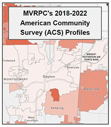
MVRPC has created a series of interactive regional profile dashboards showing ACS data from 2018-2022 5-Year estimates. This data can be viewed at four different geographic levels; Census block groups, Census tracts, county subdivisions, and places. The profiles cover a variety of both population based and housing based datapoints. Click here or on the image below to view these ACS profiles.
Please contact Elizabeth Whitaker, Principal Planner at ewhitaker@mvrpc.org, if you have any Census-related questions, from requests for specific data to help navigating the Census website.