MVRPC has been building our efforts to assist jurisdictions that hold Municipal Separate Storm Sewer System (MS4) general permits from Ohio EPA. The storm water program applies to communities within the census-defined urbanized areas of Ohio, including over 40 communities in the Miami Valley. The purpose of the program is to reduce the pollution carried in run-off water into Ohio’s rivers, streams and lakes.
Miami Valley Storm Water Seminar
June, 2019
 In June 2019 MVRPC partnered with the Miami Conservancy District to present a seminar titled, Urban Flooding and Resilience Seminar: Rain, impervious surfaces, and storm water systems. Featuring Chad Berginnis, Executive Director of the Association of State Floodplain Managers and local government leaders dealing with the evolving issue of urban flooding in the Miami Valley, the seminar delved into the changing nature of precipitation and emerging best practices for preparing for urban flooding.
Recently released by the National Academies of Sciences, Engineering, and Medicine, Framing the Challenge of Urban Flooding in the United States is a consensus study report that explores the causes, impacts, and actions for managing urban flooding in metropolitan areas. Urban flooding is the inundation of land or property in a built environment; caused by rain falling on increased amounts of impervious surfaces and overwhelming the capacity of drainage systems.
The presentations from the June 21 seminar are available:
- Introduction to Urban Flooding, Kurt Rinehart
- Non-traditional Resources, Chad Berginnis
- Framing the Challenge, Chad Berginnis
- Montgomery County, Paul Gruner
- Examples and Options, Anil Tangirala
Resource links related to Storm Water:
Ohio EPA Storm Water Program Page: http://www.epa.state.oh.us/dsw/storm/index.aspx
US EPA Storm Water Program Page: https://www.epa.gov/npdes/npdes-stormwater-program
25 Storm Water MS4 Facts: http://www.sehinc.com/news/25-stormwater-facts-25th-anniversary-ms4
Strom Water Management from the Center for Watershed Protection: https://www.cwp.org/stormwater-management/
Past MVRPC Storm Water Efforts
Miami Valley Storm Water Seminar
March, 2017
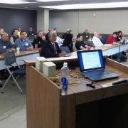
 There are over 25 communities in the Miami Valley that are required to hold and comply with a general storm water permit from Ohio EPA. MVRPC and Ohio EPA jointly planned and presented a full-morning session on the Ohio EPA storm water program geared toward these communities and the staff that are addressing storm water issues on a day to day basis. Divided into two parts, the session’s first presentation provided a general overview of the state’s storm water program, while the second section discussed current issues in storm water management.
The session was attended by 48 storm water professionals from across the Region, representing 25 different permit-holding jurisdictions. The presentations are available for download below:
- Seminar Agenda
- Storm Water Program Overview
- Ohio EPA’s eBusiness Services
- Common MS4 Audit Findings
- Illicit Discharge Detection and Elimination
- Dry Weather Screening
Northwest Montgomery County Storm Water Seminar
October 31, 2016
The expansion of the Dayton Urbanized Area after the 2010 Census brought four new communities under the Ohio Storm Water Program as new MS4 Communities: Brookville, Clay Township, Perry Township and Phillipsburg. MVRPC coordinated and hosted a workshop for these four communities to kick start their thinking about how to meet the requirements. Speakers from Ohio EPA Central Office and Southwest District Office, as well as the Butler County Storm Water District provided representatives of the communities valuable information about the program requirements. The session prompted good questions and intra-jurisdictional discussions about how to move forward. The City of Brookville kindly hosted the session in their council chambers.
Storm Water coverage mapping
The update to the census-defined urbanized area expanded (or at least changed) the coverage area of the Storm Water program for several jurisdictions, particularly those on the developing edges of the Region. MVRPC provided maps or GIS data for those communities to assist their planning for managing storm water in new parts of their communities.

