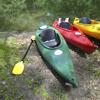
The Miami Valley Regional Planning Commission (MVRPC) recently added new river access locations to the agency’s on-going, web-based, interactive Recreational Asset Map. This update features over 90 different access points along the Great Miami River, Mad River, Stillwater River, and Twin Creek. River access points are places where people can access the rivers by boat, kayak or wading.
MVRPC’s interactive Recreational Asset Map was first developed in 2016 in partnership with the Miami Conservancy District (MCD) and the Southwest Ohio GIS Users Group (SWOGIS). Using a web-based mapping technology, MVRPC’s interactive Recreational Asset Map allows our residents to find recreational assets and learn about their amenities. For example, using a desktop computer or mobile devices, such as tablets and smart phones, a user can navigate around the Region, zoom in and out, and click on an asset to view the information such as its name, address, website link, and available amenities. Users are also encouraged to zoom to their location, by clicking on the “My Location” tool, and search for different amenities such as playgrounds, museums, or historic sites, by using “Filter by Activities” or “Find” tool.
